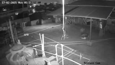
New Delhi, February 17: An earthquake that shook Delhi early Monday was caused by "normal faulting", a type of ground movement often linked to underground water or past river deposits weakening the rocks, the National Centre for Seismology (NCS) said in a report. It also said that since 1993, the area within 50 sq km of Monday's epicenter has recorded 446 earthquakes ranging from minor (magnitude 1.1) to moderate (magnitude 4.6). NCS head OP Mishra told PTI that it was not a tectonic earthquake, which refers to an earthquake that occurs when tectonic plates move.
"Major faults like the Sohna or Mathura Faults did not trigger this earthquake," he said. He said the shallow depth of the quake (5 km) made the tremors more noticeable and even produced a sound as seismic waves travelled through the air. The earthquake of magnitude 4 hit New Delhi at 5:36 AM. Earthquake in Delhi-NCR: PM Narendra Modi Urges People To Stay Calm and Alert After Quake of 4.0 Magnitude Shakes National Capital, Says ‘Authorities Keeping Close Watch on Situation’.
The epicenter was near Jheel Park, Dhaula Kuan, about 10 km southwest of Red Fort, at a shallow depth of 5 km. The tremors were felt across Delhi-NCR and nearby states. According to the NCS report, the earthquake occurred due to movement along a weak underground zone, known as a lineament, which runs in a northwest-southeast direction.
This zone has structural variations that build up stress over time, leading to quakes. Mishra said the region has a history of small to moderate earthquakes, with the strongest in recent memory being a 4.6 magnitude quake in 2007, about 6 km from Monday's epicenter. "Today's quake was caused by "normal faulting", a type of ground movement often linked to underground water or past river deposits weakening the rocks," the NCS chief said. Earthquake in Delhi-NCR: Video Showing Moments When 4.0 Magnitude Earthquake Hit National Capital Region Surfaces.
The shaking was strongest in areas with soft soil, like Lodhi Road, where the ground movement was amplified. Delhi is placed in seismic zone IV in the seismic zoning map of India, the second highest in the country. Delhi region in northern India experiences frequent tremors due to both far-field and near-field earthquakes from the Himalayan and local sources, respectively.
The national capital region is exposed to moderate to high risk seismic activity due to Himalayan earthquakes such as the 7.5 magnitude Garhwal Himalaya quake in 1803, 6.8 magnitude Uttarkashi earthquake in 1991, 6.6 magnitude Chamoli earthquake in 1999, 7.8 magnitude Gorkha earthquake in 2015 and a few moderate earthquakes from the Hindukush region.
Local earthquakes recorded in the region include 6.5 magnitude Delhi earthquake in 1720, 5 magnitude Mathura earthquake in 1842, 6.7 magnitude Bulandshahar earthquake in 1956 and 5.8 magnitude Moradabad earthquake in 1966.


 Quickly


